After sleeping (if you can call a game of doze off/wake up in 10min cycles) for around 2 hours it was time to get the car started and make my way through Glacier National Park from the West entrance, all the way through the "Road To The Sun Highway" to a few miles shy of the East entrance where I planned to capture the sunrise over Saint Mary Lake.
As the local time approached 4am, I was already sat in prime position alongside the lake which was so amazingly still compared to almost EVERY single image I had found on the internet prior to the trip. It was still completely dark at this stage, and with sunrise due to arrive around 4.45am I thought about grabbing another quick 15min snooze when it suddenly dawned (no pun intended) on me that I was miles and miles from any civilisation and was thousands of feet up in the air.
Why didn't I look up before now, argh, sometimes I really, really, really could kick myself, HARD!
It wasn't until now that I realised what I had squandered in during the few hours of sleep I had in the car.
STARS!!!!
And lots of them, I was parked around 40 miles outside the West entrance to Glacier from around midnight to 3am, and the skies were clear all night. I blame the heated seats in the hirecar for my lack of awesome star and milkyway pictures that COULD have been captured had I not fallen asleep so easily...
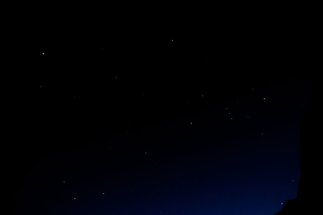
...so here is one of the small number of star shots I took while capturing the sunrise at Saint Mary Lake.
It was only now that I was beginning to wonder if I would have any others planning to enjoy the sunrise too, human perhaps, or even the large 4-legged variety, as lets face it - there's over 3000 bears in the park, a mixture of Black and Grizzly varieties, and I'm not a fan of fighting with either!
Just before 4.30am the sky was beginning to light up with colour as the sun put on it's daily show.
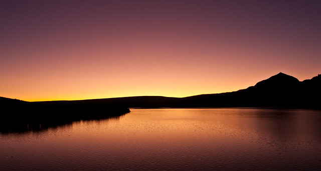 I'll be honest, after shooting a sequence of images at this stage of the sunrise, the main event itself just seemed "flat" in comparison, so I packed up the kit and drove a few miles back West to where I could shoot back into the mountains of the park, with Saint Mary Lake still in the foreground, and using Wild Goose Island to break up the surface of the lake.
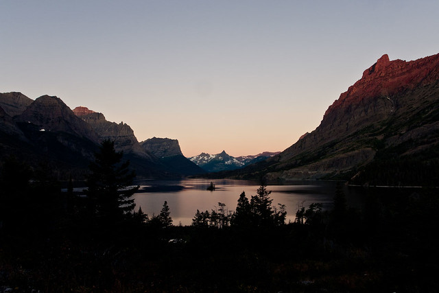
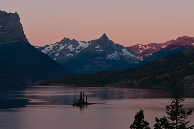
You can see the sunlight is just starting to spill onto the tops of the mountains which guard the waters of the lake below it, at this stage is was around 5.45am.
 This
location was probably the place that I was most jumpy, as I was the
only person standing in this area, down in the woods, with nothing but
trees, bushes, and lots of nice hiding places for those bears...This location was probably the place that I was most jumpy, as I was the only person standing in this area, down in the woods, with nothing but trees, bushes, and lots of nice hiding places for those bears...I reckon every time I hit the shutter button standing there I did a complete 360 degree scan of my surrounding area incase I needed to make an emergency sprint back up to the car, thankfully nothing appeared and I spent the next hour there capturing the changing light over the lake and mountains.
This
location was probably the place that I was most jumpy, as I was the
only person standing in this area, down in the woods, with nothing but
trees, bushes, and lots of nice hiding places for those bears...This location was probably the place that I was most jumpy, as I was the only person standing in this area, down in the woods, with nothing but trees, bushes, and lots of nice hiding places for those bears...I reckon every time I hit the shutter button standing there I did a complete 360 degree scan of my surrounding area incase I needed to make an emergency sprint back up to the car, thankfully nothing appeared and I spent the next hour there capturing the changing light over the lake and mountains.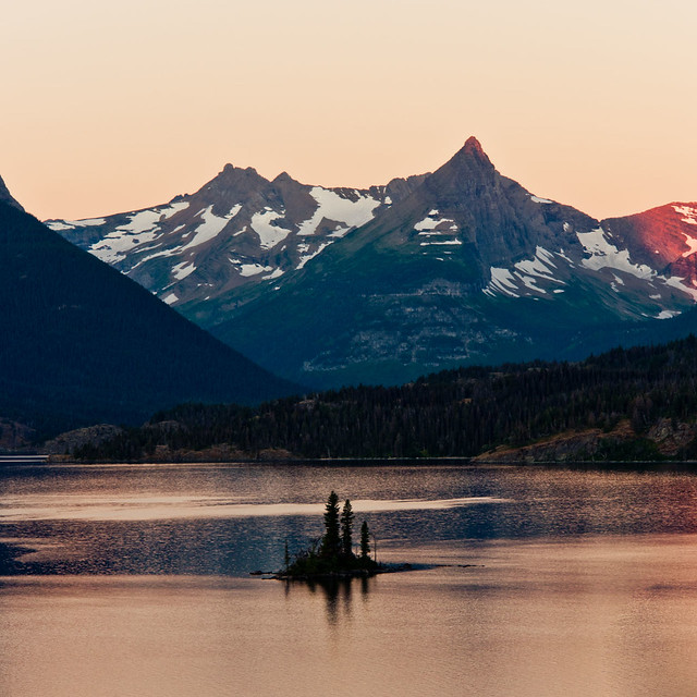
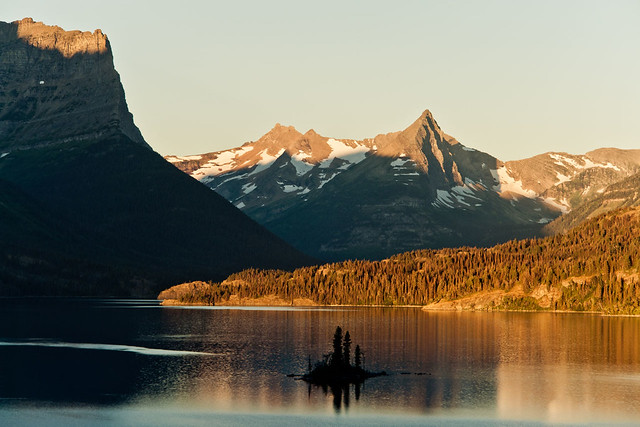
Almost as quickly as the colours over the lake became pinkish, they began to transition to a more reddiish-orange glow, as the sun began to spread it's light on the hills which surround the lake.
It's at this point in time where the light is changing pretty much second by second that it gets tougher and tougher to keep everything exposed just enough to prevent blowing out the highlights or the shadows looking like they are still in the dead of night.
I have seveal custom functions set up on my 60D, which this photo  is shot on instead of my normal Sony R1 that takes care of the normal landscape shots. Using the 60D also let me through the scene into wide angle mode as I had brought along my 10-20mm lens among others.
 is shot on instead of my normal Sony R1 that takes care of the normal landscape shots. Using the 60D also let me through the scene into wide angle mode as I had brought along my 10-20mm lens among others.
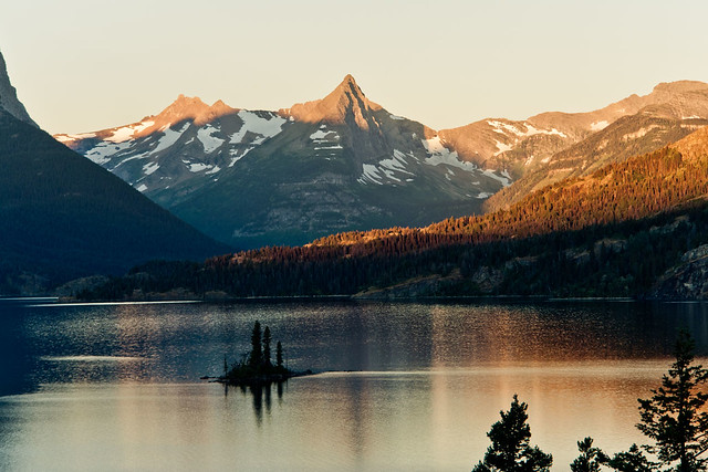
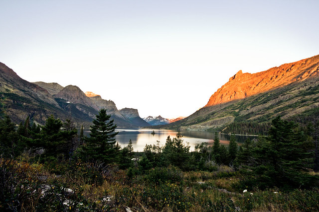
The light begins to spread onto the hillside, bringing colour to all that was shadow.
In this one you'll see that the water looks pretty plain now, with some reflection showing but quite bland.
Now, only a matter of minutes later the light has filled the bank of the lake with colour, and the water which looked quite bland only a few minutes earlier now displays a colourful reflection of the bank.
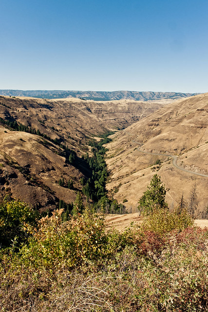
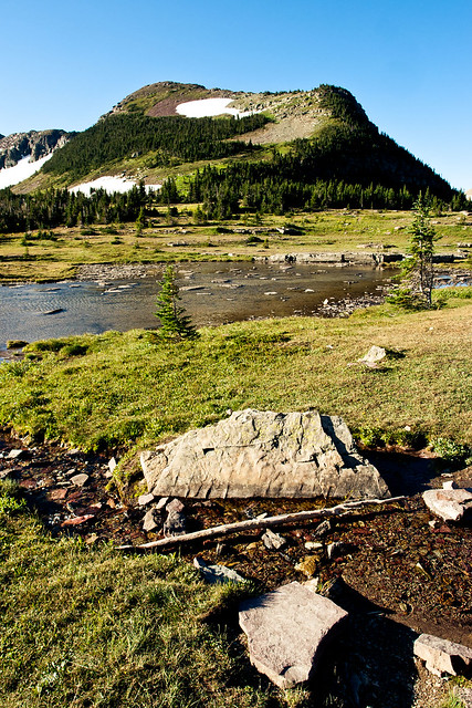
The next hour or so I slowly made my way from Rising Sun on the banks of Saint Mary Lake, West along the Road To The Sun Highway - this time in daylight, which allowed great views of some of the mountains which make up the National Park.
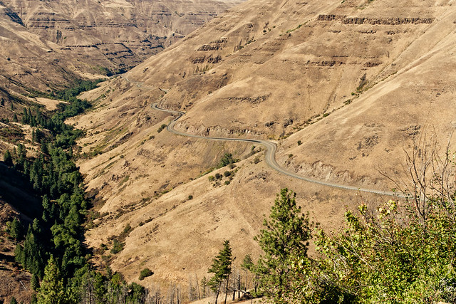
As I drew close to the Visitor Centre high up in the mountains at  Logan Pass I could get an idea of what lay off to the sides of the road that I had driven along in the dark of night - huge drops off the side of the cliff!
 Logan Pass I could get an idea of what lay off to the sides of the road that I had driven along in the dark of night - huge drops off the side of the cliff!
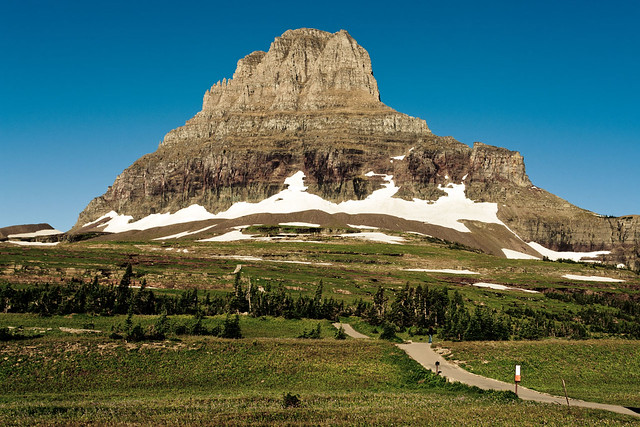
The carpark at Logan Pass normally begins filling up quickly from around 9am, which for most people is the timeframe that they intend to reach it - for me that "normal time of day" was still a good 90mins away when I parked up the car and after picking up the gear, made my way up past the Visitor Centre towards Clements Mountain.
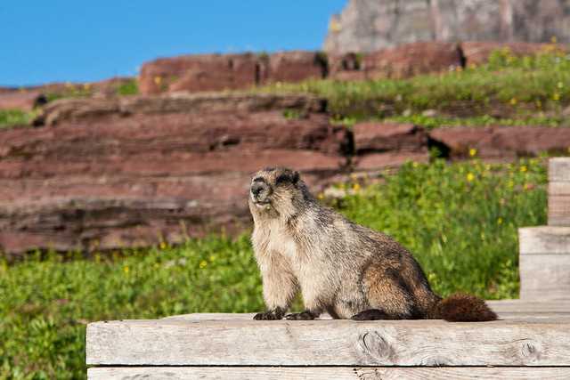
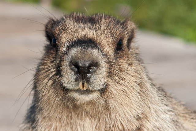
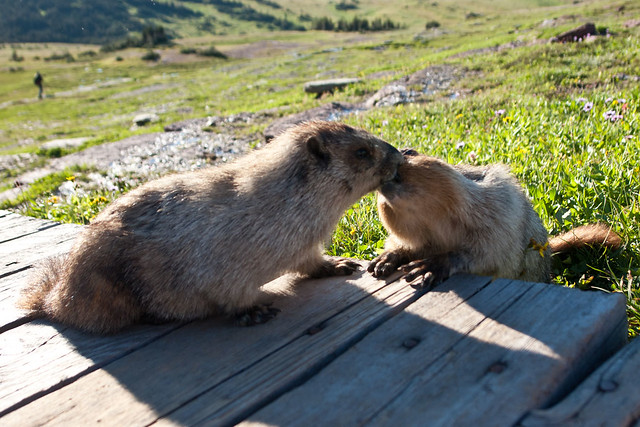 You can already see the start of the path which leads you up towards Clements Mountain, before swinging over it's left flank en route to Hidden Lake which lies a few miles away. After around a few hundred feet the stone path turns into a raised wooden walkway which winds it's way over the Alpine meadow. The Apline meadow is home to hundreds of Marmots, which is a cousin of the squirrel - but is MUCH larger than it...
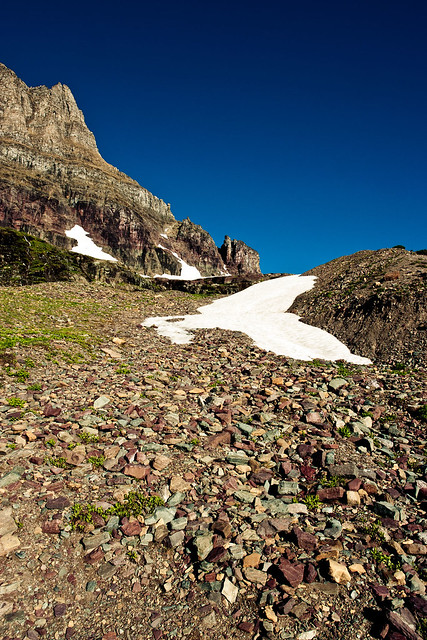
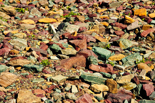
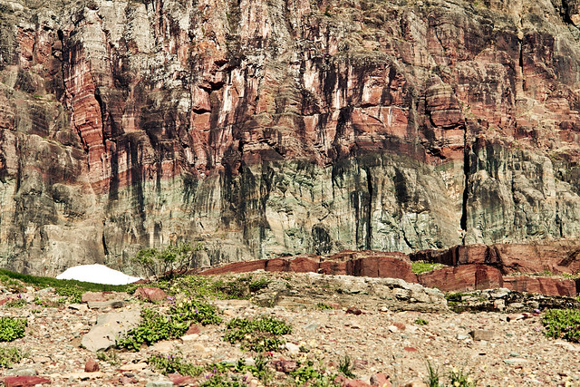
As you approach the base of Clements Mountain there are large areas littered with loose rocks that have broken away from it's parent mountain.
The colours which show up in the stone slurries are down to the large variety of minerals which are abundant in the mountains of Glacier National Park.
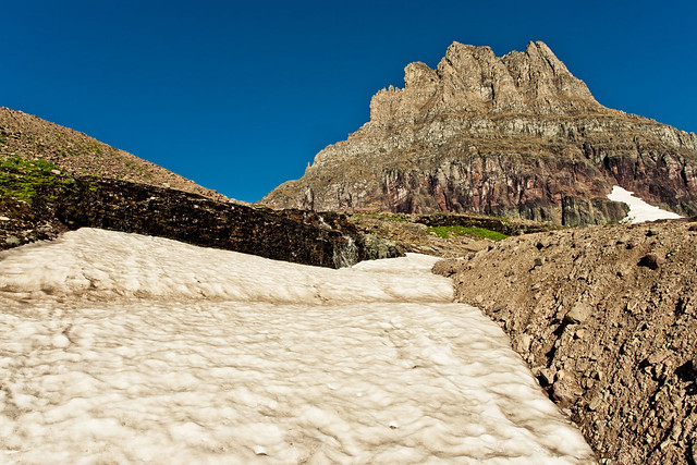
On the plateau which lies to the South of Clements Mountain the pathway winds itself through another section which has has a large rockfall and a small lake which has come into being due to all of the snow which has melted recently.
There's still plenty of snow around the park, albeit patchy now that it's September. It won't be long until the snow begins to fall and makes this area impossible to reach easily for the best part of another year.
As you get closer to the cliff faces of Clements Mountain there's  a much better view of the changing colours which make up the mountain.
 a much better view of the changing colours which make up the mountain.
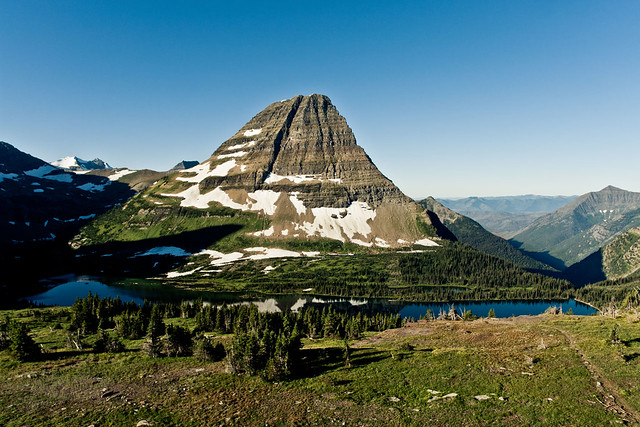
Another half mile or so hike finally brings the scenery which holds Hidden Lake in it's arms into view with Mount Brown towering behind it.
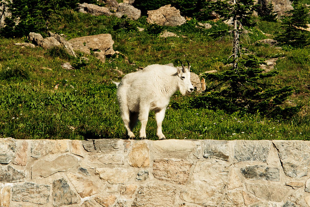
Again, hiking through areas of the vast winderness has you a little on edge as far as keeping your eyes peeled for the local wildlife, thankfully the only animals other than the Marmots that I came across were a few goats who only seemed a little miffed at me wandering across "their" turf!